| Controls | Display | Errors | Antenna | Plotting |
Radar
Plotting
Radar plotting
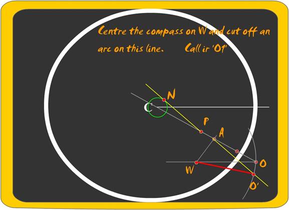
With the advent of ARPA, the necessity of a paper plot has reduced, however the plot is mandatory and it also helps if navigators use this to keep a counter check on the performance of the ARPA results after a certain interval of time.
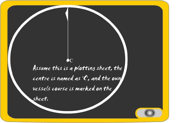
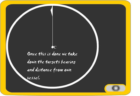
The paper plot is started with plotting sheets, but the non-availability should not be a deterrent to the plot.
The principle of a paper plot is the vectors and the
direction of the vectors.
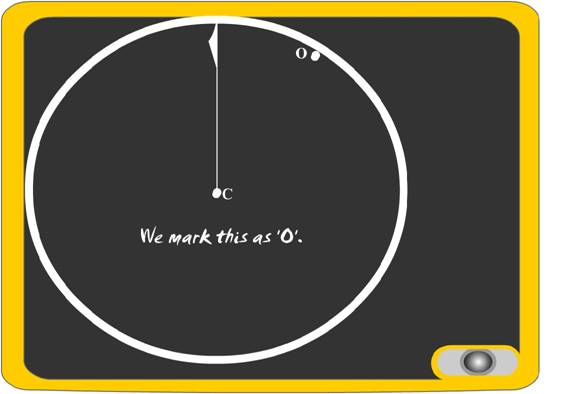
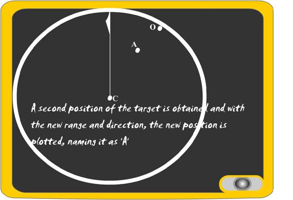
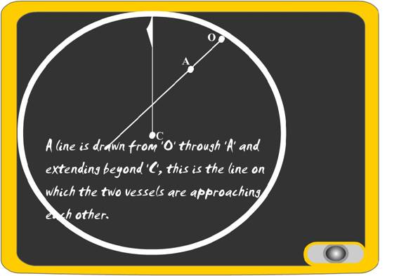
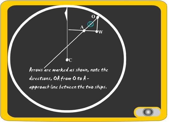
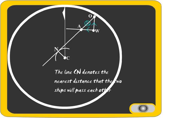
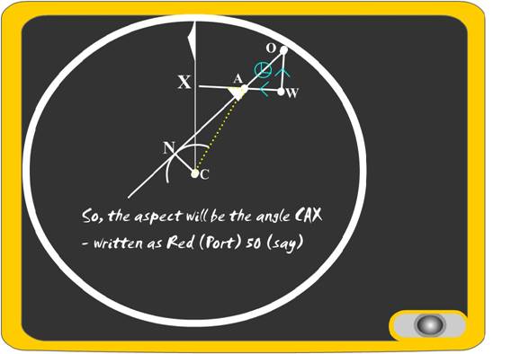
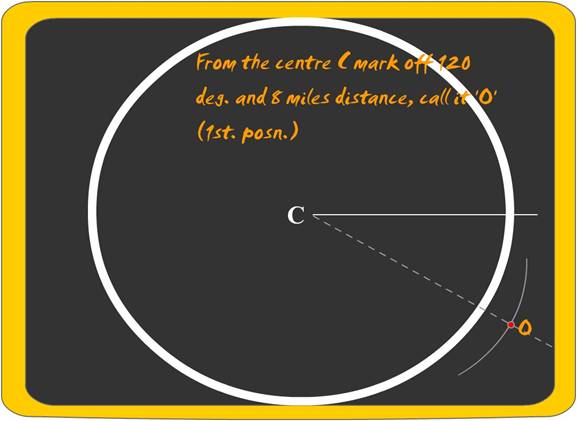
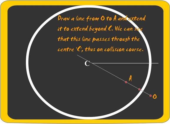
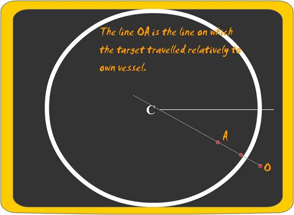
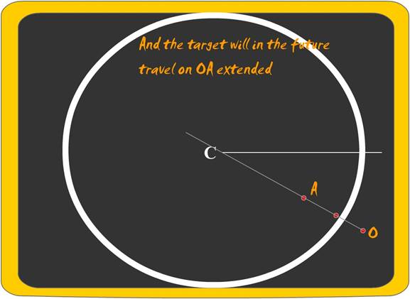
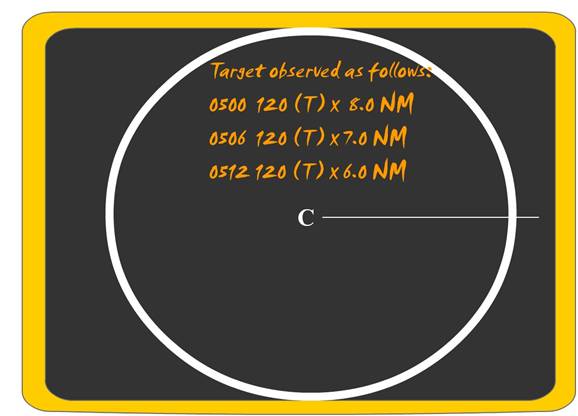
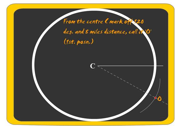
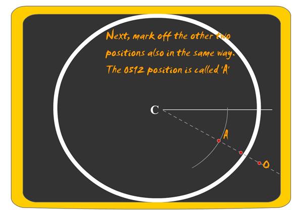
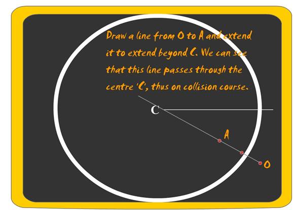
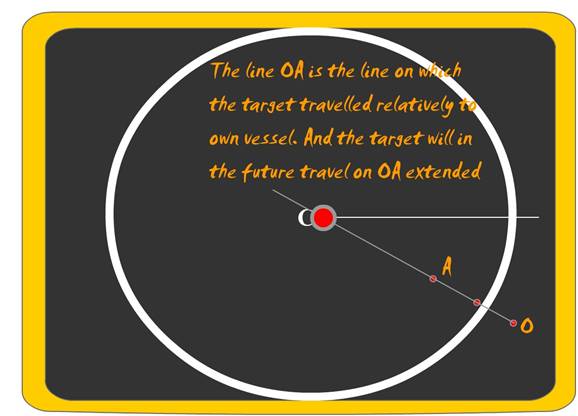
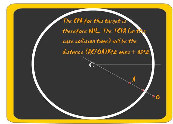
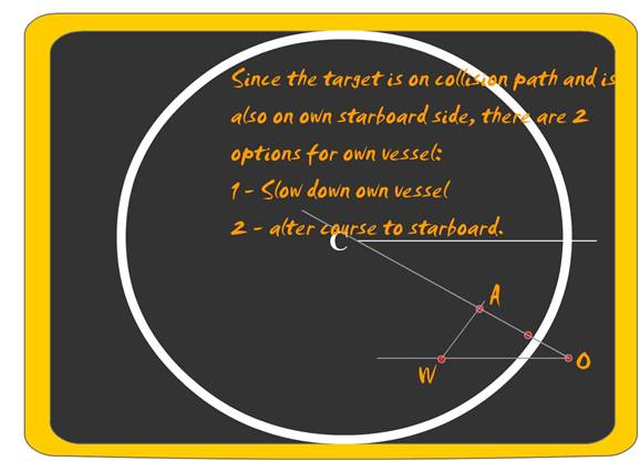
OA– starting from o and ending in A – represents the
approach line of two vessels (one of them being the own vessel)
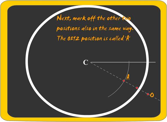
First position is always O and the last position is
A.
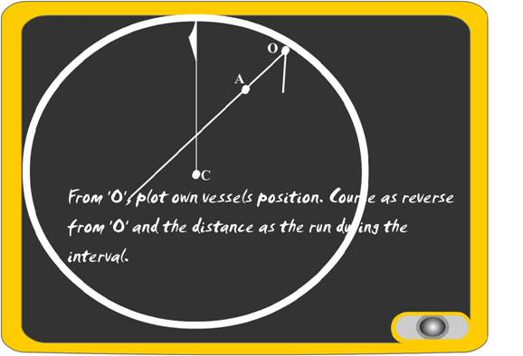
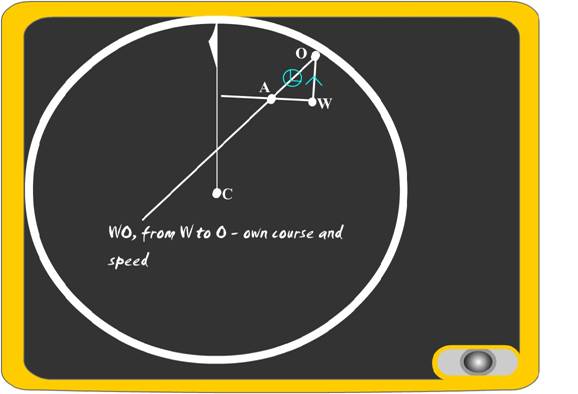
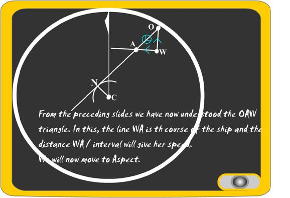
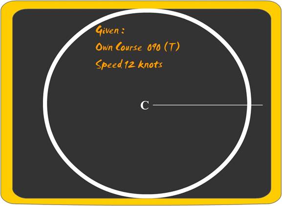
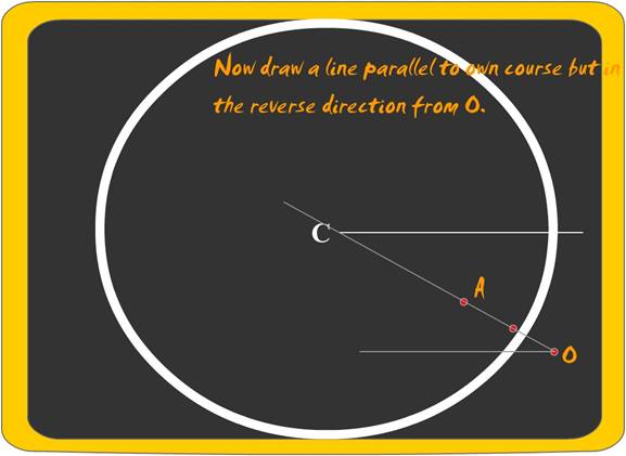
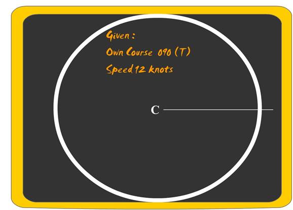
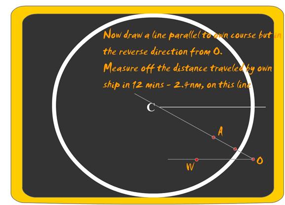
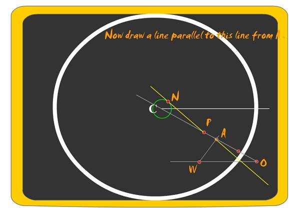
Once the line OA has been drawn, the own vessels
course and speed are used to draw the direction and length from the point O.
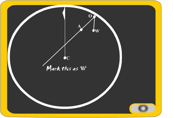
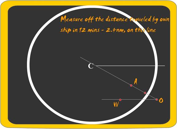
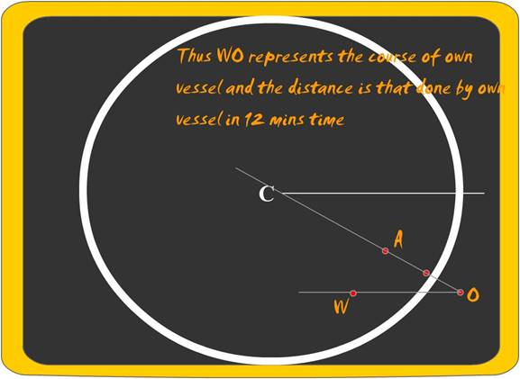
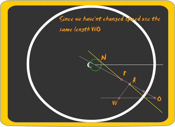
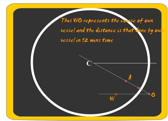
This line OW (only to be used once) fixes the position
of the point W, this is the position of reference for
all future vectors. The moment w is fixed the line OW is to be called for all
future purposes as WO.
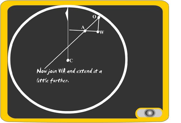
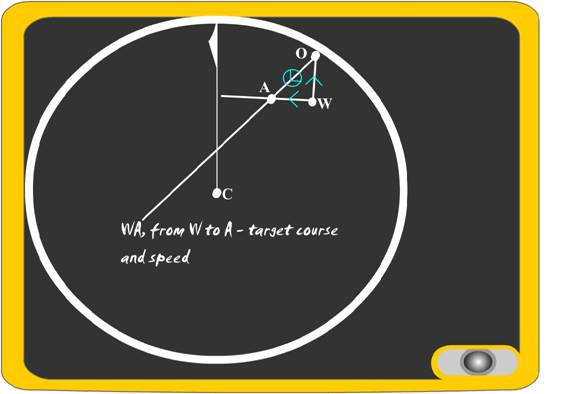
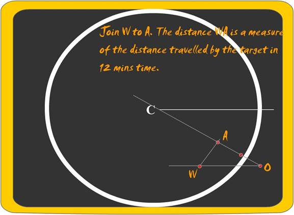
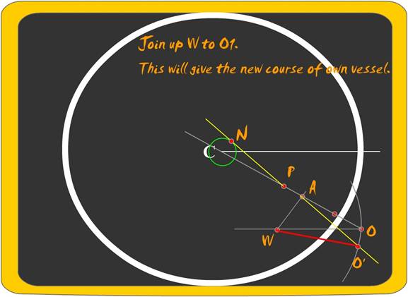
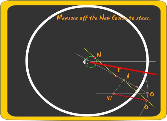
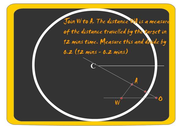
The subsequent line WA gives the course direction and
the speed of the vessel.
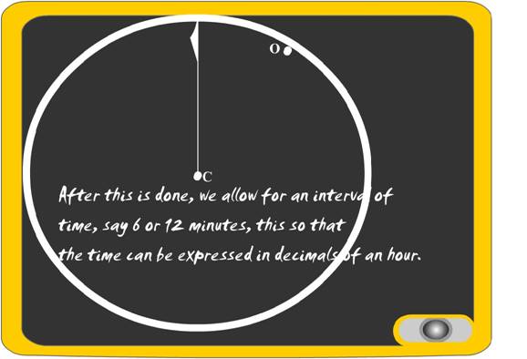
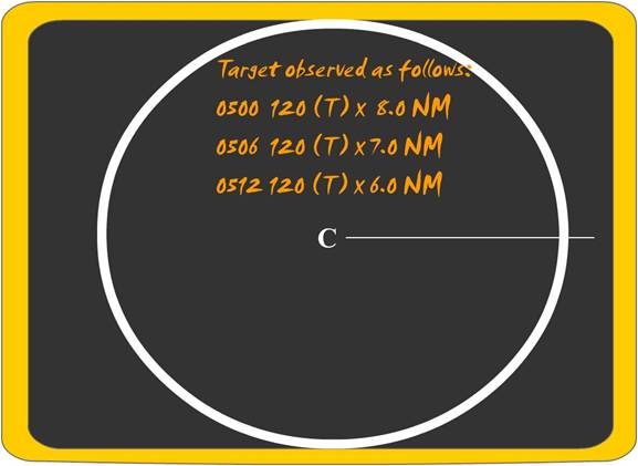
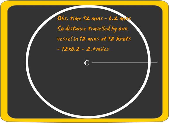
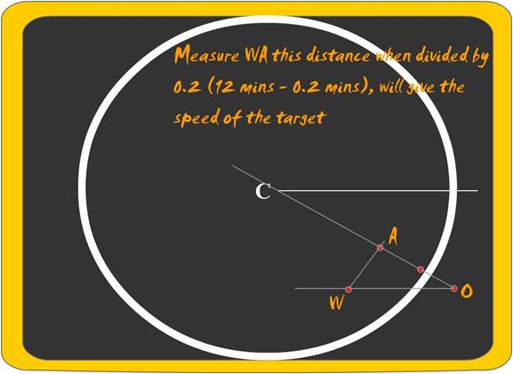
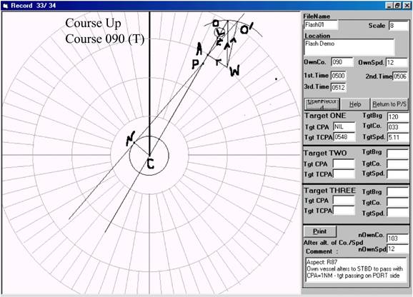
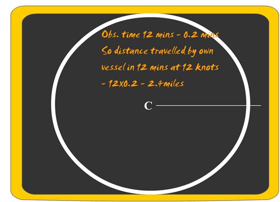
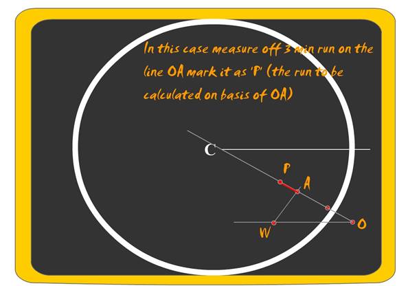
The plot intervals are chosen as 3m, 6m or 12m. Since
these are decimals of an hour and once one vector OA is done in this time frame
all vectors are to be calculated in the same time frame. The length of the line
WA is to be taken and converted to distance traveled in the time interval and
thus the speed of the target is found.
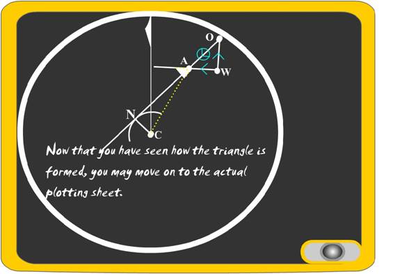
Forming the Triangle for use in
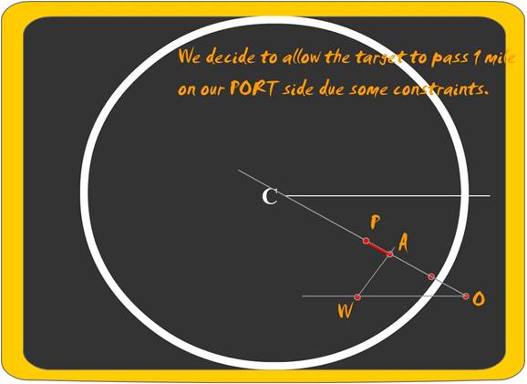
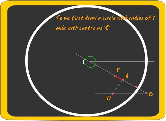
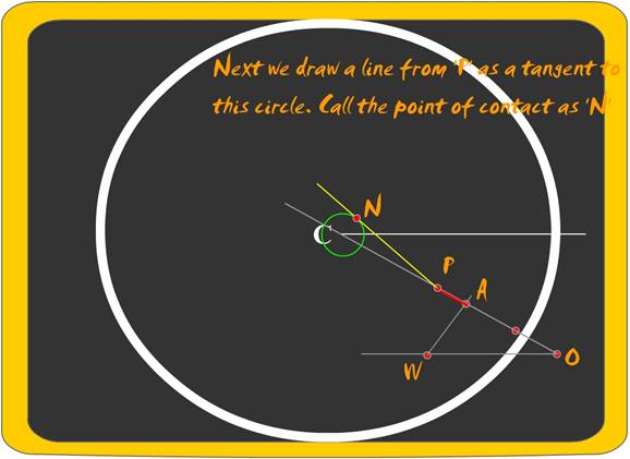
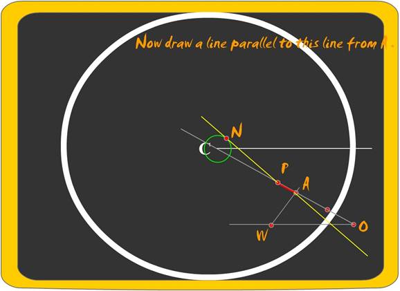
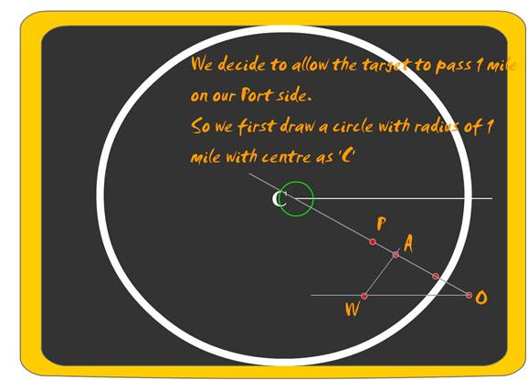
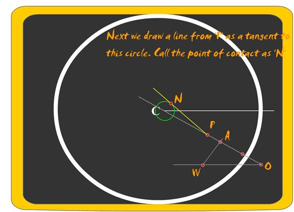
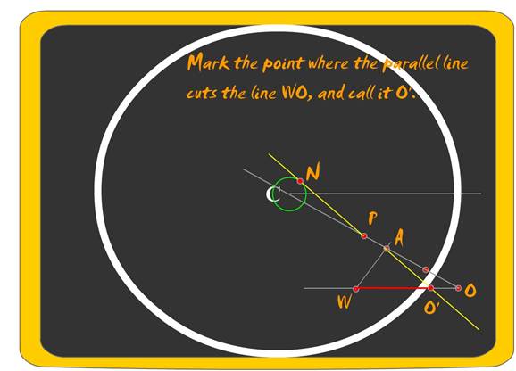
case of altering COURSE of own vessel. – Altering COURSE to pass a vessel at a pre- determined distance
Forming the Triangle for use in
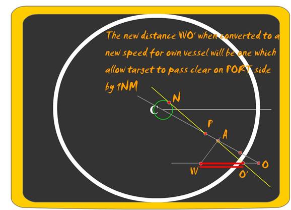
case of altering SPEED of own vessel. – Altering SPEED to pass a vessel at a pre- determined distance


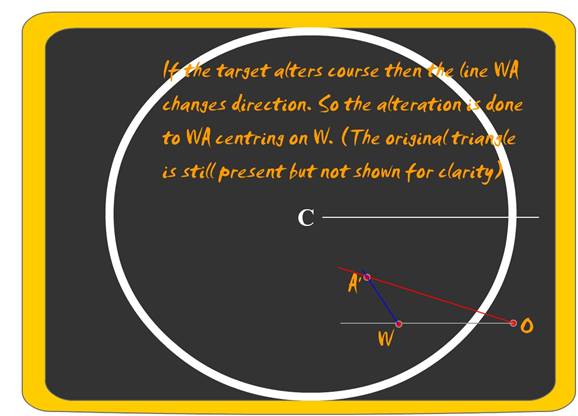
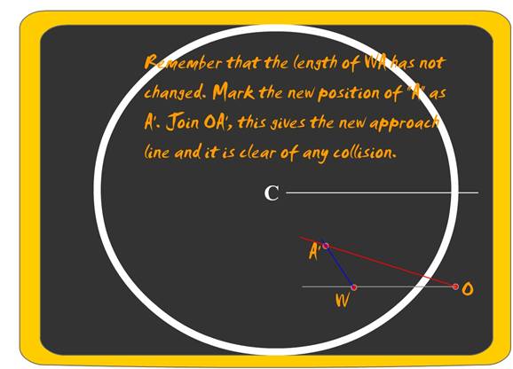
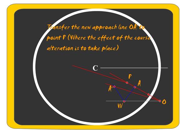
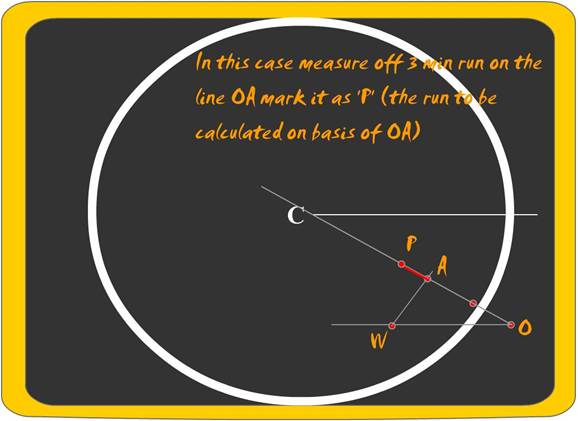
Alteration of course by other vessel after a certain time interval of the original Plot